FAQ
-
The Utah Snow Measurement and Forecasting Program, or Utah Snow, is a developing statewide effort to improve water-supply forecasting by combining advanced snowpack measurement, distributed snowpack modeling, streamflow forecasting, and water-resources operations modeling. The initial focus is on producing forecasts that are directly useful for reservoirs, diversions, conveyance systems, and other key water infrastructure in Utah.
-
Utah Snow is in an early development stage. Utah already has two basin-scale airborne snow measurement pilots: the Colorado River Authority of Utah's Flakes, Flights, and Forecasts project in the Uinta/Wasatch headwaters and the Utah Division of Water Resources' Wings Over Weber project in the Weber River Basin. The first project has produced repeated survey, snowpack-model, and streamflow-forecast products through the 2026 runoff season. Wings Over Weber is scheduled to continue through 2027. The statewide program concept is intended to organize lessons, data products, funding, and future expansion from these efforts.
-
Approximately 95% of Utah's water supply comes from snowpack, according to the Utah Division of Water Resources. Snow acts as a seasonal reservoir that accumulates through the winter and supplies streams, reservoirs, irrigation systems, municipalities, and ecosystems during spring and summer. Because so much of Utah's supply begins as snow, errors in estimating snow volume or runoff timing can propagate directly into water-supply and infrastructure decisions.
The program is intended to improve the observed starting condition used in runoff forecasts and to provide more spatial detail than is possible from ground stations alone. It also creates a framework for carrying hydrologic forecasts into detailed predictions of reservoir and diversion operations.
-
The primary users are organizations that make recurring water-supply or water-operations decisions. Potential users include:
Reservoir operators and water conservancy districts
Irrigation companies and agricultural water providers
Municipal and industrial water suppliers
Utah state water agencies and the State Engineer
Federal reservoir, forecasting, and water-management agencies
Tribal water organizations and other Colorado River water users
Environmental and watershed programs that depend on runoff timing and instream flows
The program should be designed so that smaller water providers can benefit from regional measurement and forecast products without having to maintain their own advanced modeling program.
-
The intended product chain is:
1. Basin-scale measurements of snow depth, SWE, albedo, and snow volume from ASO flights.
2. Distributed snowpack model estimates between flight dates using iSnobal and other observations.
3. Ensemble streamflow forecasts that estimate runoff volume, timing, and uncertainty.
On the strength of these datasets, the program coordinators will help with integration of these measurement and forecast products with on the ground decision-making. This may include estimates of reservoir yields, diversions, key streamflow conditions, and other metrics.
-
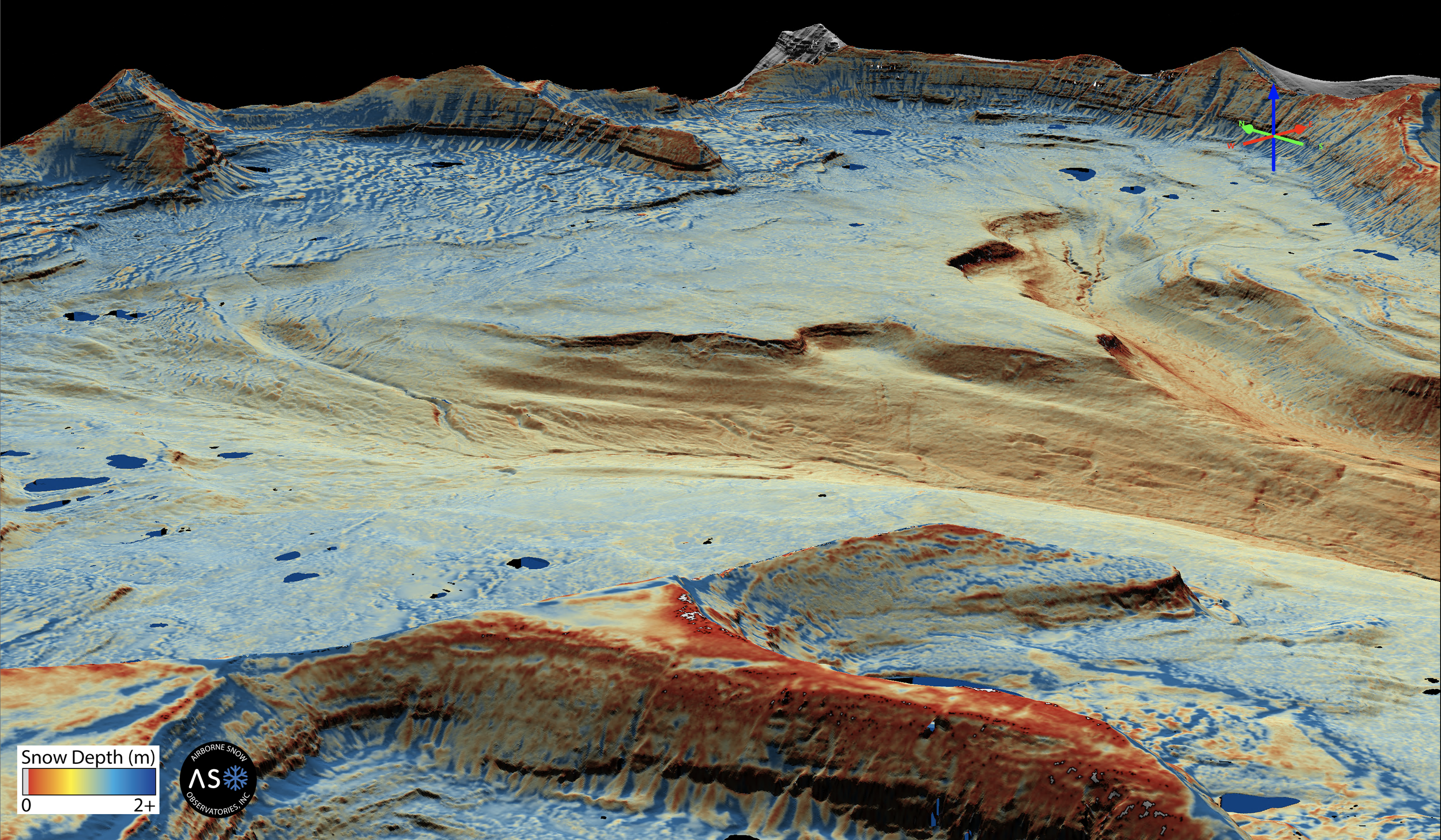
Airborne Snow Observatories, Inc. uses aircraft-mounted lidar and imaging spectroscopy to measure snow conditions over an entire watershed. Lidar measures surface elevation very precisely. A snow-free baseline survey establishes the ground elevation. A later snow-on survey measures the elevation of the snow surface. Subtracting the snow-free surface from the snow-on surface produces a spatial map of snow depth.
The imaging spectrometer measures snow albedo, which is important to snowmelt timing. Snow depth is combined with modeled snow density to calculate snow water equivalent, or SWE. In the Utah pilot workflow, iSnobal is used to represent snow density and snowpack evolution, and the resulting snow state is used to improve WRF-Hydro runoff forecasts.
-
SWE is the depth of liquid water contained in the snowpack. It is the most useful measure for water-supply planning because it describes how much water is stored in the snow rather than simply how deep the snow is. Basin-scale SWE can also be integrated over area and expressed as a total water volume, such as acre-feet.
-
SNOTEL is essential to western water management. It provides continuous, long-term measurements of SWE, precipitation, temperature, and other variables at fixed mountain locations. The limitation is spatial representativeness, not the accuracy of the station measurement itself.
A SNOTEL basin index summarizes conditions at a selected set of stations, commonly as current station SWE relative to each station's historical median. That index is useful for describing how monitored locations compare with normal conditions. It is not a direct measurement of the total volume of water stored in snow across the watershed.
A watershed may include large areas above, below, or between the elevations represented by stations. Snow also varies with aspect, wind redistribution, forest cover, storm track, and melt timing. In unusual years, those spatial differences can cause station-based indices to diverge materially from the actual basin-wide snow volume. ASO directly maps snow depth across the watershed and therefore provides a spatial inventory that can be integrated into a basin or sub-basin water volume.
-
No. The most useful observing system combines them. SNOTEL provides continuous measurements and a long historical record. ASO provides a detailed basin-wide snapshot. Ground observations are also used to validate airborne measurements and constrain snow-density modeling. Snowpack models then use both types of information to estimate conditions between airborne surveys.
-
iSnobal is a physically based, spatially distributed snow energy- and mass-balance model. It represents accumulation, melt, snow density, and other snowpack processes across a watershed. M3 Works operates an implementation of iSnobal that can assimilate ASO measurements and other observations to maintain an evolving estimate of the snowpack between flight dates. This fills an important time gap because airborne surveys occur on selected dates rather than continuously.
-
WRF-Hydro is a distributed hydrologic modeling and forecasting system used to simulate watershed processes and streamflow. In the Utah pilot, the snow state produced from ASO observations and snowpack modeling is used to update the hydrologic model and generate ensemble runoff forecasts. The ensemble provides a range of plausible outcomes rather than only a single seasonal volume number.
-
The next step is to connect the hydrologic forecasts to detailed water-resources operations models. For a reservoir system, the useful forecast is not only natural runoff. Operators need expected inflow, storage, releases, flood-control space, spill risk, diversion capability, downstream requirements, and the timing of each condition. For a transbasin or distribution system, the forecast may need to include source availability, conveyance constraints, water-right priority, delivery targets, and operational alternatives.
The original Utah USBR pilot anticipated this connection through UCRAF, the Utah Colorado River Accounting and Forecasting model. Utah Snow should continue this work so that measurement and streamflow forecasts are translated into the variables managers actually use.
-
No. The program should be treated as an additional measurement and forecasting capability. A central part of the Utah pilot is comparing ASO-informed forecasts with open-loop model forecasts, observed runoff, and forecasts from operational agencies. Over time, those comparisons can show where the added information improves forecast skill or reduces operational uncertainty.
-
Flight dates should be selected around hydrology and decision timing, not a fixed calendar alone. A survey before or near April 1 can inform early-season planning. A survey near peak accumulation can improve the estimate of total seasonal snow storage. A later survey during melt can show remaining high-elevation snow and help update runoff timing and remaining volume. Aircraft operations also depend on suitable weather and cloud conditions.
-
Much of eastern Utah drains to the Colorado River, and the Uinta pilot includes headwaters that support both Utah water uses and the larger Colorado River system. The basin is operating under prolonged drought, low reservoir storage, and increasing infrastructure risk. In August 2026, the U.S. Department of the Interior finalized operating guidelines for 2027-2028 and a decision framework for coordinated Lake Powell and Lake Mead operations through 2036. Reclamation cited the record-low 2025-2026 snowpack and historically low reservoir elevations as key operating constraints.
Utah Snow does not determine interstate allocations or resolve Colorado River supply constraints. Its role is operational: improve Utah's estimate of annual mountain water supply, runoff timing, and forecast uncertainty, then carry that information into forecasts for reservoirs, diversions, conveyance systems, and other Utah infrastructure. Better local forecasts give Utah water managers more useful information for decisions made within a constrained Colorado River system.
-
Item descriptionThe 2026 water year is a useful example of why this work matters. Utah reported its lowest snowpack since statewide records began in 1930, with peak snowpack occurring about three weeks early. By late August, the entire state remained in some form of drought and statewide reservoir storage had declined to about 52%. Years that fall outside normal historical relationships are an important test of whether station indices, spatial snow measurements, snowpack models, and streamflow forecasts continue to represent the actual water supply.
-
Not necessarily. The statewide program should prioritize watersheds where better measurement is likely to change a forecast or an operational decision. Some basins may justify repeated annual surveys. Others may benefit from periodic calibration, targeted surveys during unusual years, or improved ground and satellite monitoring instead. Program expansion should be based on decision value, cost, forecast performance, and partner needs.
-
Current ASO survey data are available through the ASO data portal. Current Utah pilot reports are also posted by the Colorado River Authority of Utah, and Wings Over Weber information is posted by the Utah Division of Water Resources. UtahSnow.org should eventually provide one organized index to these sources by water year and basin.