SNOTEL and ASO: Point Measurements vs. Watershed Snow Volume
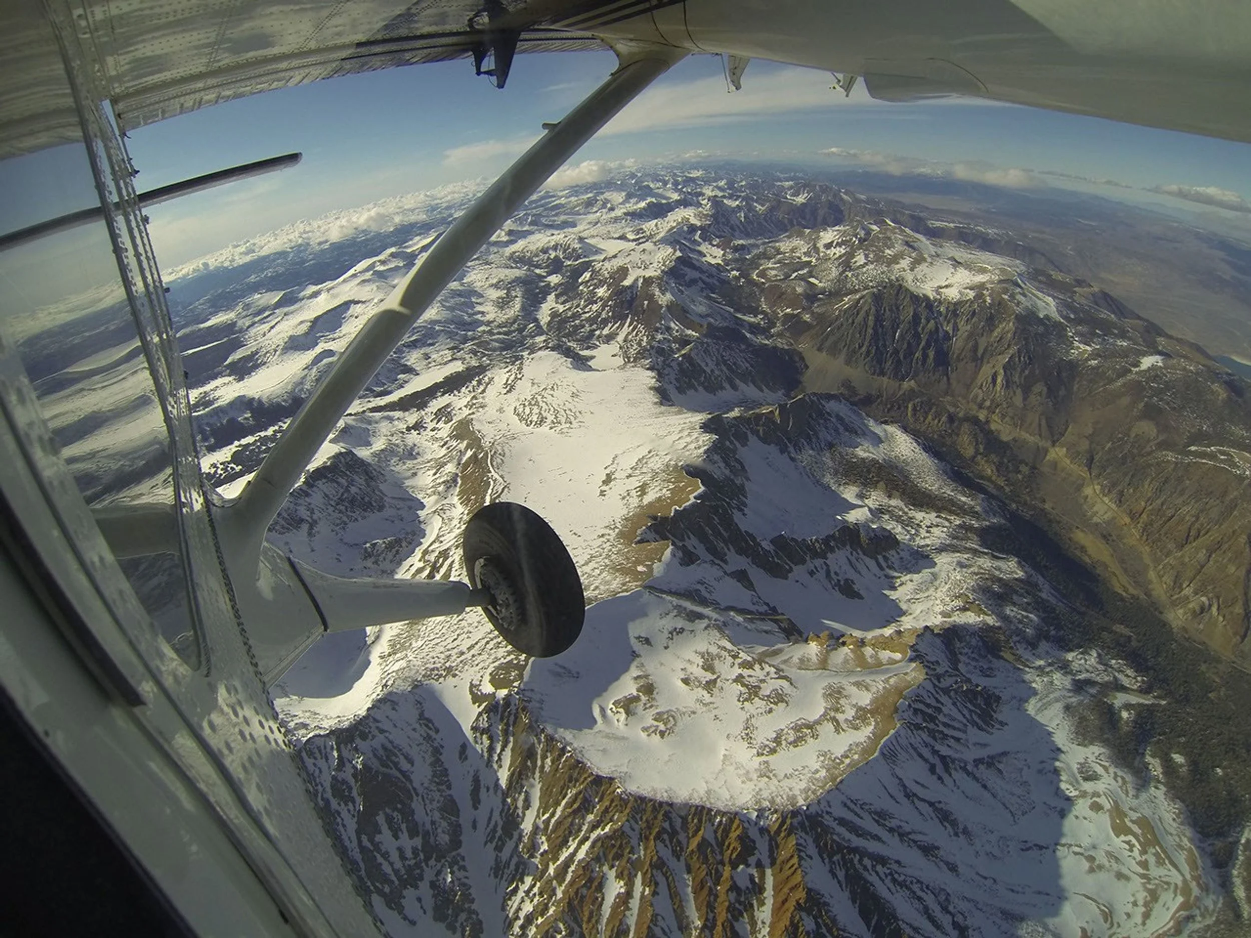
PIA17771 Credits: NASA/JPL-Caltech
The issue is spatial representation, not station accuracy
SNOTEL stations are a foundational part of western water management. They provide continuous measurements at fixed locations and long records that are indispensable for tracking current conditions and comparing them with historical years. The limitation arises when a small number of station measurements are used as a proxy for the total snow volume in a large mountain watershed.
A SNOTEL station can be measuring conditions accurately at its location while still being unrepresentative of the basin as a whole. This is a sampling problem, not a sensor problem.
Why station location matters
Mountain snowpack varies strongly over short distances. Factors that can cause station conditions to differ from basin-wide conditions include:
Elevation. Stations may not represent the highest parts of the watershed where late-season snow persists.
Aspect. North- and south-facing slopes can accumulate and melt snow at very different rates.
Wind redistribution. Snow can be removed from exposed terrain and deposited in sheltered terrain that is not represented by a station.
Vegetation and exposure. A sheltered station site can retain snow differently than open slopes, forests, ridges, or wind-exposed terrain.
Storm track. Individual storms can favor one part or elevation band of a watershed and weaken the historical relationship between a station and basin runoff.
Melt progression. A station can melt out while significant high-elevation snow remains elsewhere, or retain snow while lower and exposed portions of a basin have already depleted.
Utah pilot example
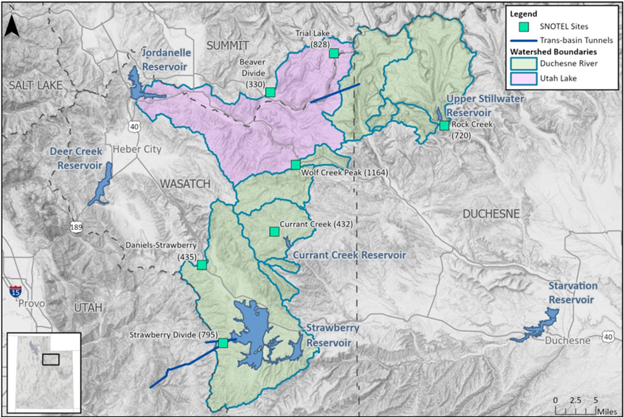
In the original USBR project area, seven SNOTEL sites were identified within the Utah Lake and Duchesne headwater domains, with station elevations ranging from approximately 7,886 to 9,992 feet. The two project domains total roughly 747 square miles. Those stations are valuable time-series measurements, but seven locations cannot directly observe every elevation, slope, aspect, forest condition, and storm-distribution pattern across that area.
What ASO adds
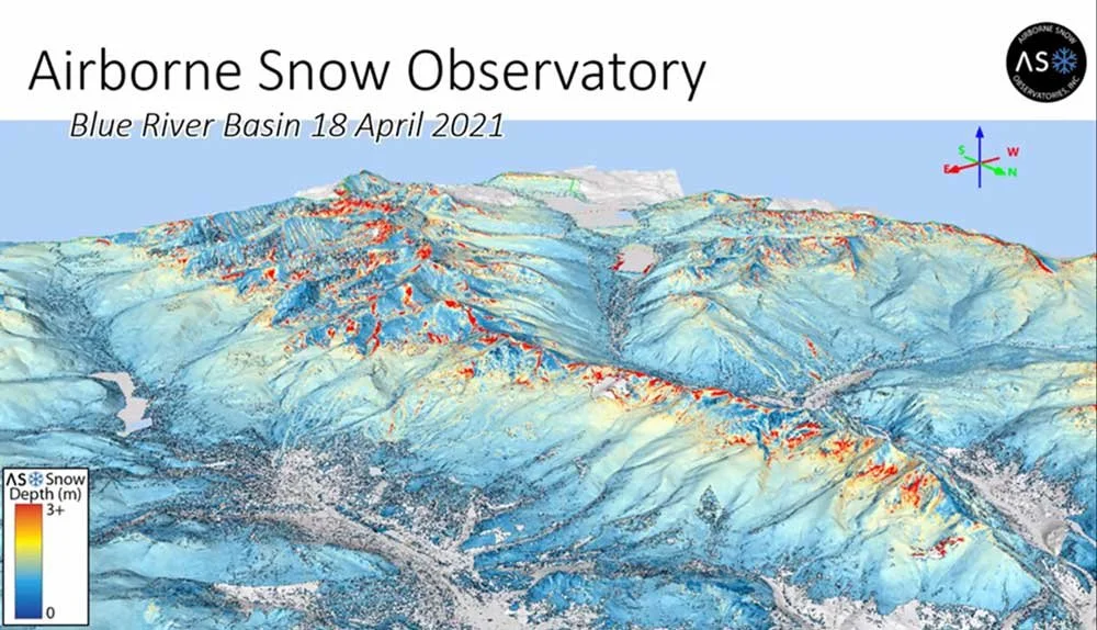
ASO measures snow depth across the surveyed watershed rather than at a handful of locations. Combined with snow-density modeling, those measurements produce distributed SWE. The distributed SWE grid can then be integrated over the basin, sub-basin, or elevation band to estimate the actual volume of water stored in the snowpack in acre-feet.
That basin-volume estimate addresses a different question than the SNOTEL index. SNOTEL asks, in effect, “How do these monitored locations compare with their historical condition?” ASO asks, “How much snow water is spatially distributed across this watershed on the survey date?” Both are useful, but they are not interchangeable.
How basin-index error can affect forecasts
If the station network is more or less snowy than the unmeasured portions of a basin, a forecast calibrated primarily to the station index can begin with an incorrect estimate of total snow storage. In a typical year, historical relationships may compensate for some of that difference. In an unusual year, the relationship can break down and lead to a meaningful error in expected runoff volume or timing.
ASO reduces this spatial representativeness uncertainty by directly observing the basin snow distribution. The hydrologic model still has to represent melt, losses, soil moisture, weather, and routing, so the ASO survey does not eliminate all forecast error. It provides a better observed snow initial condition from which to make the forecast.
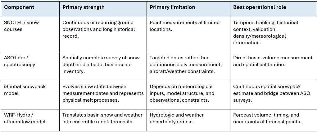
The recommended observing system uses all four components: